Monday, August 26, 2013

Day 148: Rangely

Day: 148 Miles: 13.2 Trip: 1965.5 Started: ME17  Destination: ME4, Rangely ME


Today was the easiest day yet in Maine.  The trail up from ME17 was a little steep but that would be as hard as the day was going to be. It threatened to rain all day but only managed to stay gray and windy.  As I approached Sabath Day Pond I head the sound of waves breaking.  Its a sound I have not heard in so long that I mistook it for wind.  I miss the sound of the ocean and the waves breaking on the small beach made me think of home.

Rangeley is the last town near the trail that has a full grocery store so stopping here makes sense to some degree and if I did not need to resupply I don't think I would have stopped so soon.  There are not that many reasonable places to stay in town but Mike and Shirley Schrader offer space in their back yard for tenting.  It was a nice clear night and I was able to stretch and extension cord over to my tent to charge my phone.   Tomorrow morning we will resupply and head on towards Stratton, the next place to resupply.  I have only been carrying about three days of food at a time and I hope to continue this all the way to Katahdin.

Just when I need it...
Poof a privy appears right ON the trail.  It even
 has its own blaze.

Saturday, August 24, 2013

Day 146

Day: 146 Miles: 13 Trip: 1952.3 Started: South Arm Rd.  Destination: ME17

On top of Old Blue
Well, we decided to slack pack one more day.  I'm glad we did.  With the trail being as hard on my feet as it is, this was a smart option.  I do not want to take any more zeros than I have to and slack packing helps with that.  Today the trail bit back!  Up to this point we have had increasingly better trail.  Today was a little different.  Even though there were not that my climbs, the constant up and downs were back and going was a little slow.  Nobody said Maine would be easy!  We ended up at ME17 right next to lake Mooselookmeguntick.  I'm told by our host at the cabin that it was named by a local Indian showing a settler how to hunt.  'Moose, look, me gun tick (bang)'. 
The overlook where the trail comes out on ME17 was a great view.
 

View from Bemis Mt.


Friday, August 23, 2013

Day 145

Day: 145 Miles: 10.1 Trip: 1939.1 Started: East B Hill Rd.  Destination: South Arm Rd

Surplus Pond
Another day of slack packing out of The Cabin. 
An ominous warning at
the start of the day
I can't say enough about 'Honey' and 'Bear'.  They are a great couple that have been helping hikers on the AT fro almost 20 years.  Today's hike was another surprise as far as terrain goes.  Even though we have had at least two to three 2000 foot climbs a day for the past few days, the trail seems easier and easier to get down.  Perhaps the steep loose rock sections of the Whites have me feeling that everything else is a little easier.  Even though there are sections that are just as steep, there are better and better footings available as I move north.  The better footing makes for faster travel and it's not nearly as frustrating as it has been in the past week.  I can attribute some of my current energy to being close to finishing but most of it is probably from having good meals and a place to sleep for the past two nights.  It will be hard leaving The Cabin.  I think we can swing one more slack pack and then it will be on to Rangeley.

Thursday, August 22, 2013

Day 144

Day: 144 Miles: 10.6 Trip: 1929.0 Started: Grafton Notch  Destination: East B Hill Rd, ME

View from Table Rock
We are going to slack pack the next two stretches from The Cabin.  We had a great all you can eat breakfast for only $5 and set out for the trail. Right at the start of the day I came to a sign promising a 'extraordinary view'.  Normally I would not have even considered a 1 mile diversion just for a view, but I was slacking and looked back with a little regret at other views I have skipped.  The view was just fair but I am glad I did it.   In general the trail today was the best trail I have had since Vermont.  Sawyer notch was the only strenuous section of trail today.  It would be great if rest of Maine was like this section, but that would be delusional at best.  Even so, it was nice even for a little while. The climb up to Bald Pate was a huge smooth rock climb and was one of my most fun climbs so far.  There were some great long stretches without difficult obstacles and it was really nice to get a nice stride going.


Wednesday, August 21, 2013

Day 143: Grafton Notch

Day: 143 Miles: 9.7 Trip: 1918.7 Started: Full Goose Sh.  Destination: Grafton Notch, ME

The trail is getting a little easier, to a point.  Today there were quiet a few stretches were I could actually walk and not think about every single step.  Everything was going great until we got to Mahoosuc Notch.  Mahoosuc Notch is described as either the hardest or most fun mile on the trail.  I have to say that it was both hard and fun. 
The Notch is a steep ravine filled with car and large truck sized boulders.  There is no obvious trail though the section and I found myself jumping and crawling over many boulders.  The fact that we could see vultures circling the section as we entered was not a good omen.  Moose have been known to get stuck in the notch and I did not want to encounter a cornered moose, fortunately we did not see one. 
Climbing around in the notch was fun, but immediately after leaving I was faced with the Mahoosuc Arm, an exposed 1500 climb. 
We hit the arm in mid afternoon and the sun and blue skies made for an awesome climb.  I really enjoyed this stretch despite the tough conditions.  I would hate to think what this would be like if it was raining.  Speaking or weather, we have had an amazing stretch of good weather.  The famous Maine mud has been in check for the most part, a true blessing. 


Spec Pond


Tuesday, August 20, 2013

Day 142: Maine !!!

Day: 142 Miles: 9.6 Trip: 1909.0  Started: Gentian Pond Sh.  Destination: Full Goose Shelter, ME

Today I see my final border crossing.  I'm now in Maine!  It seems so surreal to be here.  Back in Georgia the thought of making it this far was just a distant possibility.  I never doubted that I would make it this far, just that it was almost too far away to comprehend at the time, but I am finally here!  I can now say that I have walked from Georgia to Maine!

The talk of the southern Maine mountains is all true.  This stretch is tiring.  There are many miles of trail that just go up and down about 20' at a time.  While not long climbs, the constant changes really slow me down.  Even though the trail was tough, I could not be more happy to be in my final state.  I don't think anything could get me down today.

Up and down, all day long.
It's easy to get Katahdin fever even though I am still 270 miles from finishing.  I am already thinking ahead to home and all the projects Mary has in store for me, and am looking forward to all of it.

Tonight we are heading in to East Andover and The Cabin.  The Cabin is cross between a trail angels home and a hostel.  They have such a good reputation that I even heard about this place all the way back in Georgia.  They offer slack packing for a very reasonable price and we both want to do some of this rough terrain without a full pack if possible.  We called Don from The Elbow trail and they graciously offered to pick us up at Grafton Notch.  They even said they would hold dinner for us, an unexpected bonus.

View from Goose Eye Mt.

Monday, August 19, 2013

Day 141

Day: 141 Miles: 11.8 Trip:  Started: Gorham, NH Destination:  Gentian Pond Shelter

The Gentian Pond shelter offers a great view.
This will be my final day in NH.  The mountains today have been pretty tough.  I have been told for a while now that the mountains in southern Maine are tougher than the Whites and if today is any indication of what is to come then the next few days will be tough.  The trail has been a little easier for the most part, but the technical drop offs are more common and difficult than they were in the Whites.  The Whites had many long steep ups and down, where here the trail is more gradual but the steep sections require much more finesse to get down.  I need to pick up my miles, but was only able to get 11 in today.  Hiking with Chin Music was fun and I look forward to the Mahoosuc range and the stretch into Stratton with him.  I fear he may be on a slower pace than I and I might have to split off from him to finish by early September. 

Sunday, August 18, 2013

Day 140: Gorham NH

Day: 140 Miles: 14.9 Trip: 1887.6 Started: Carter Hut  Destination: Gorham, NH 

The weather today was pretty good and despite the rough trail I was able to get down to US2 by about 6pm.  I am staying at a hostel that offers free shuttle rides to town.  While in town I caught up with Chin Music.  I have been trying to catch up with him since NJ and it was great to see him again.  We both agreed that the Whites were some of the hardest trail we have had so far and both opted to split a hotel room the next day and take a zero.  Gorham is just outside the Maine border and we both felt a brief day to rest was in order.

The next day at the hotel was great.  The front desk clerk offered to give us her car for the afternoon!  This is one of the best bits of random kindness yet on the trail.  We were able to drive to the post office and grocery store for a resupply.   The maintenance man at the hotel even offered to give us a ride back to the trail head.  If you ever stay in Gorham, make sure to stay at the Mt. Madison motel, the staff there was great!


Friday, August 16, 2013

Day 139: Wildcat Ridge

Day: 139 Miles: 14 Trip: 1872.7 Started: Madison Hut  Destination:  Carter Hut

Many of the south bounders (sobo's) I have seen in the Whites have warned me about how bad the decent from Madison is.  I had a long day planned so I headed out early at about 6:30am.  The climb to the top of Madison was pretty easy with well cut trail.  At the top I started a very long ridge line down to the tree line.  The trail in this section is tough, but not as bad as I had heard.  It took about five hours to get down to Pinkam Notch.  I had made pretty good time so I decided to push on up Wildcat Ridge.  What a mistake!  After I started up the mountain the rain set in and it was a very long stretch up to the next hut.  There are not very  many camping spots on the ridge and I opted to try for my third work for stay.  Luckily I think they took pity on me being as soaked as I was and offered to let me stay with not work at all. 
Ridge line down from Madison
I ended up helping clean up after dinner and enjoyed a dry spot to sleep.  The huts really worked out for me.  I had heard many people complain that they were not able to get work for stays at any of the huts, but I guess I just had good timing.  The best time to show up is between 4:30pm and 7pm when they are in the middle of dinner rush, this seem to be the best time to get a stay.  Wildcat so far is far harder than the Presidential range, never ending 200' climbs and descents make for slow going.

Thursday, August 15, 2013

Day 138: Mt Washington / Madison Hut

Day: 138 Miles: 7 Trip: 1858.7  Started: Lakes of the Clouds Hut  Destination: Madison Hut


An ominous sign just after
leaving the hut
One of the lakes on a
foggy morning
We got some pretty strong wind and rain last night.  I was glad to be up in the dining room relatively warm.  Lakes of the Clouds has a 6 bunk room in the basement affectionately called 'The Dungeon'.  I went down to take a look and it was really not that bad but I still feel the dining room floor was a little better.

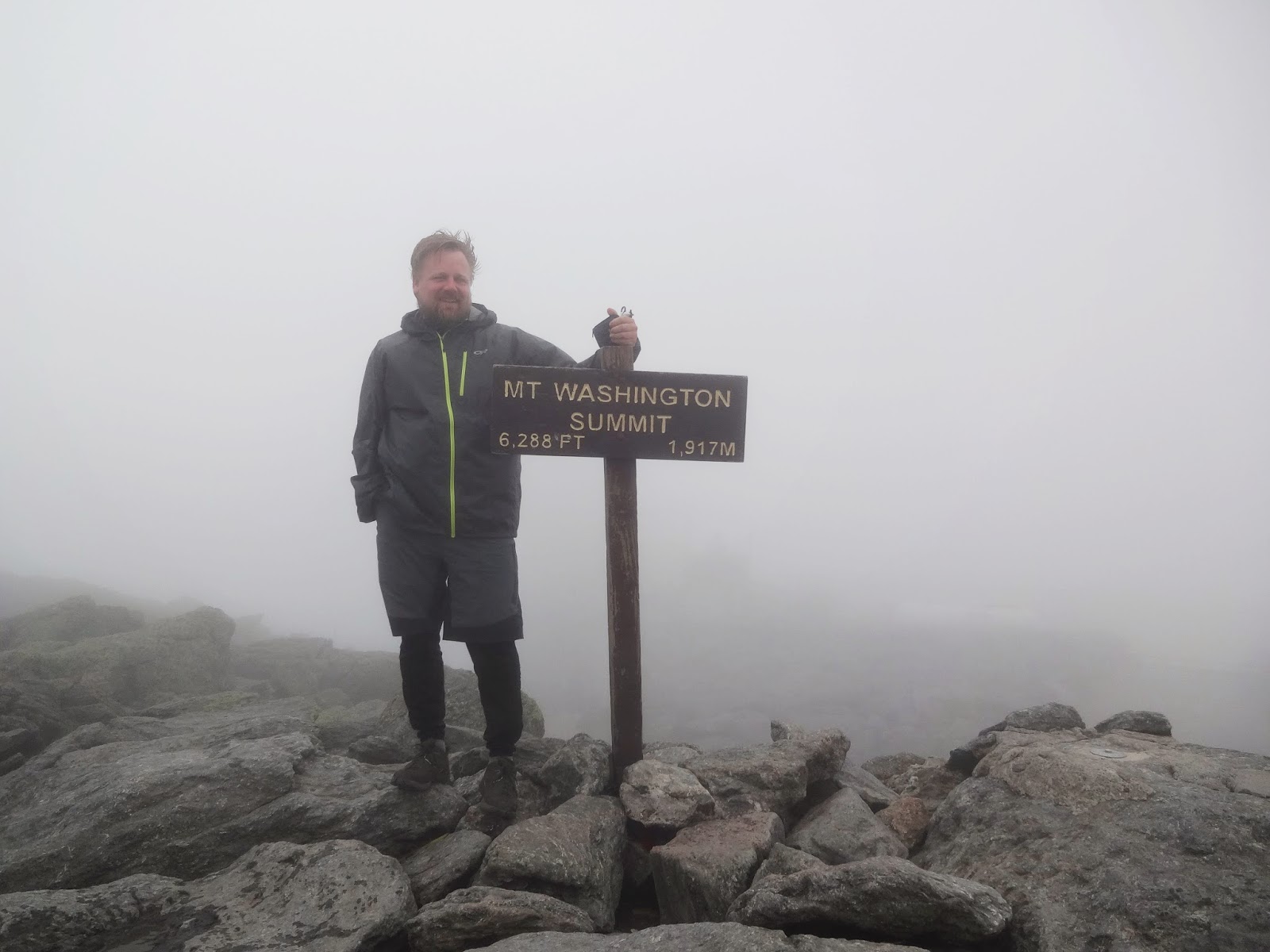
I set out for Mt. Washington, the second highest point on the AT,  at about 7am and the fog was still very thick.  The weather report for the day is calling for clear skies at about 12pm.  It is only 1.5 miles from Lakes to the summit and I was at the visitor center by about 9am.  There are three ways to get to the summit of Washington; foot, the cog railway, and by car.  At about 9:30am the first train from the bottom came up and the visitor center started to fill up quickly.  I really wanted a clear view from the summit so I decided to get something to eat from the grill here and wait out the fog.  I waited until about 1pm and the clouds were still blocking the views.  I guess I'll have to come back one of the easy ways sometime.  I stopped off at the summit to get my picture and then headed on down the AT.  After Mt. Clay and Mt. Jefferson it was starting to get late.  At the top by Thunderstorm Junction I had the option of going down to tree line to find a camping spot or continuing on to Madison Hut.  The huts complicate things for through hikers. 

They are not a sure thing unless you spend quite a bit of money for a reservation.  Not wanting to go over a mile downhill out of my way I opted to head for the hut.  Luckily I was the third to ask for work for stay and got a spot.  My chore here was to turn the composting pile.  It was a great view of the sunset and the job only took about 10 minutes.   Two work for stays in a row was great and I did not have to go far off the trail to find a camping spot.  The trail today was pretty easy except for the climb up near Thunderstorm Junction.  After I left the summit of Washington the clouds started to clear up at a slightly lower elevation and the visibility really improved.


Mt Madison and Madison Hut
Mt. Washington from Mt Jefferson

Wednesday, August 14, 2013

Day 137: Lakes of the Clouds

Day:  137 Miles: 11.2 Trip: 1851.7 Started: Crawford Notch Destination:  Lakes of the Clouds


Today is the first day in the Presidential range of the Whites.
The morning started out overcast with low fog but just after the side trail to Mt. Jackson the fog started to lift. For a brief time I was able to see more than 100 feet but by the time I reached Eisenhower the dense fog was back. Despite the poor visibility I enjoyed this stretch above the tree line.  The temperatures are great and the fog gives the trail an unearthly feeling.  I was not able to see the hut until I was about 200 feet away.

I arrived at about 3pm and was able to arrange 'work for stay'.  The hut system is reservation only but often through hikers can arrange to work for a spot on the dining room floor. Lakes of the Clouds in one of of the easier huts to do this at because there are so few camping options on the mountain. My work was to wash pots and pans from the dinner service.  We had about 10 hikers there for the night and the shared work load was a nice change if pace.  Work for stay usually includes a meal and we were treated with pulled pork for dinner.  Around 9pm the wind really picked up and we got reports that Washington peak only 1.5 miles away had sustained winds of over 85 miles an hour.  I was glad to be inside for the night!


Tuesday, August 13, 2013

Day 136

Day: 136 Miles: 17.4 Trip:  1840.5  Started: Garfield Ridge Sh.  Destination: Graford Notch 

The day started out with another very steep downhill.  The weather report for today is calling for more rain.  We got an early start out of the shelter to put in as many miles as possible.  Early in the afternoon the rain set in and we decided to take a shorter trail down to the notch. 

Somewhere on the way down Jay decided that this was not the vacation he had envisioned.  I think he was very up for hiking more, but the terrain in this stretch is truly quite tough.   Vacation days are important and he did not want to get back from is vacation less rested than he started.  I cant fault him at all for this logic.  This stretch would be much more enjoyable if it was done in a series of days with larger rest periods between climbs.  The views here are truly grand, but they really do make you pay for them.

We took a shuttle back to his car from the Grafton Notch and found a cheap motel in Gorham for the night.  In the morning he will be able to shuttle me back to where I left off.


Monday, August 12, 2013

Day 135: Franconia Ridge

Day: 135 Miles: 10.3 Trip:  1823.1 Started: Franconia Notch Destination: Garfield Ridge Sh.

Today was simply breathtaking.  These are the views we have been waiting for in the Whites.  The climb was getting to be pretty typical, rocky steep and high.  Today's climb to the ridge was about 4500 feet.  Words don't do it justice, so I think I will just post a lot of pictures.  I think I took more pictures on the ridge today than I have in all of Massachusetts and Vermont.  The climb down to the shelter was very deceptive.  The scale of the views here make everything seem just a little closer than it is.  It's only when I see a hiker as a spec on a distant part of trail that I realize what I am looking at is several miles away.  We got into the shelter at about 7pm after a great day on the ridge.  I am really glad the weather was so good for this section.  A true highlight.